 Back to the Gallery
The Glungezer, is a mountain to the southeast of Innsbruck. It is about 400m taller than the nearby Patscherkofel that is much more prominently visible from Innsbruck and hosts a broadcast tower.
Besides a mostly underground, military air defense installation, the Glungezer mountain also hosts an Alpine Society lodge, the Glungezerhütte, located in the saddle between the actual Glungezer peak and the Sonnspitz. The hut is only reachable on foot, providing for a nice hike up.
A picture of the Glungezer hut that I took in June of 2017, coming down from the actual Glungezer peak. The Sonnspitz peak can be seen at the left of the frame, the hut itself is in the bottom right. The Inntal can be seen in the background.

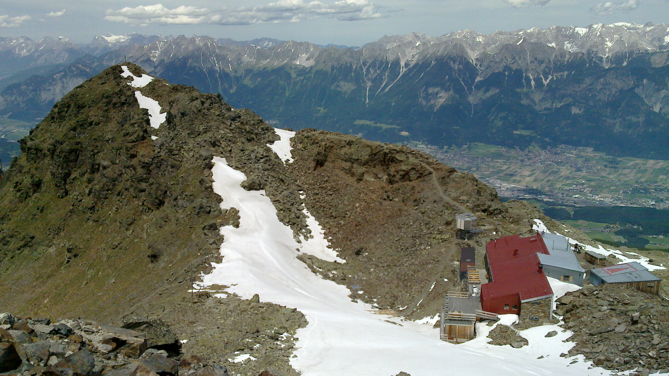
A look back at the western side of the hut on the day we left, walking down towards Patscherkofl. This picture was taken in June of 2022.
The RTCE, or Summit on a Summit used to be a small, multi-day conference, taking place at the Glungezer hut.
The setting of the conference is more relaxed, typically consisting of realtime Linux related discussions over food, drinks and the nice view of the Austrian alps.
The following are photos I took at the RTCE conference in 2022, looking from the hut into the Inntal, and looking back as we made our way up to the peak.

View from the hut down into the Inntal, looking north and slightly to the east. The divide between Hall in Tirol and Mils can be seen to the left of the image center. With Baumkirchen, Frtizens et al to the right as the the valley extends to the east.

Looking east along the Inntal from the same vantage point as in the image above.

Looking down from the Goldhaube military installation into the Inntal, looking north. The building on the left is a small military installation with a material ropeway. The roof of the builing further down is the material ropeway belonging to the Glungezer hut.

Walking further south towards the Glungezer peak, looking back north.

View from the peak, looking west. The Patscherkofl radio tower can be seen on the right.

Looking south west, the Stubaital, and particularly the Serles can be seen in the distance.

Looking north east, along the Inntal.

Looking east into Voldertal.

Towards the end of the Voldertal.

Another view down into the Voldertal.

Towards the west, along the Inntal.

Looking north, across the Inntal. The border between Hall and Mils is roughly at the center of the image.

And another view towards the east of the Inntal.
After the conference, we made our way down at the west side of the mountain, towards Patscherkofl, joining onto the Zirbenweg, walking back to the Glungezerbahn.

Looking north west with the Patscher Kofel radio tower close to the center of the image. The Inntal expanding to the west can be seen in the background. Looking closely below and to the right of the picture, the trail can be seen snaking along the mountain in the distance.

Same vantage point, looking south.

Inside a gondola of the new Glungezer Bahn, looking across Innsbruck.
 Back to top Back to top
|
| |
Back to the Gallery
|